Flight test on 24.10.2021 in Hermuthausen to investigate the performance of standard mobile cellular phone network technology in the lower airspace.
1. Overview
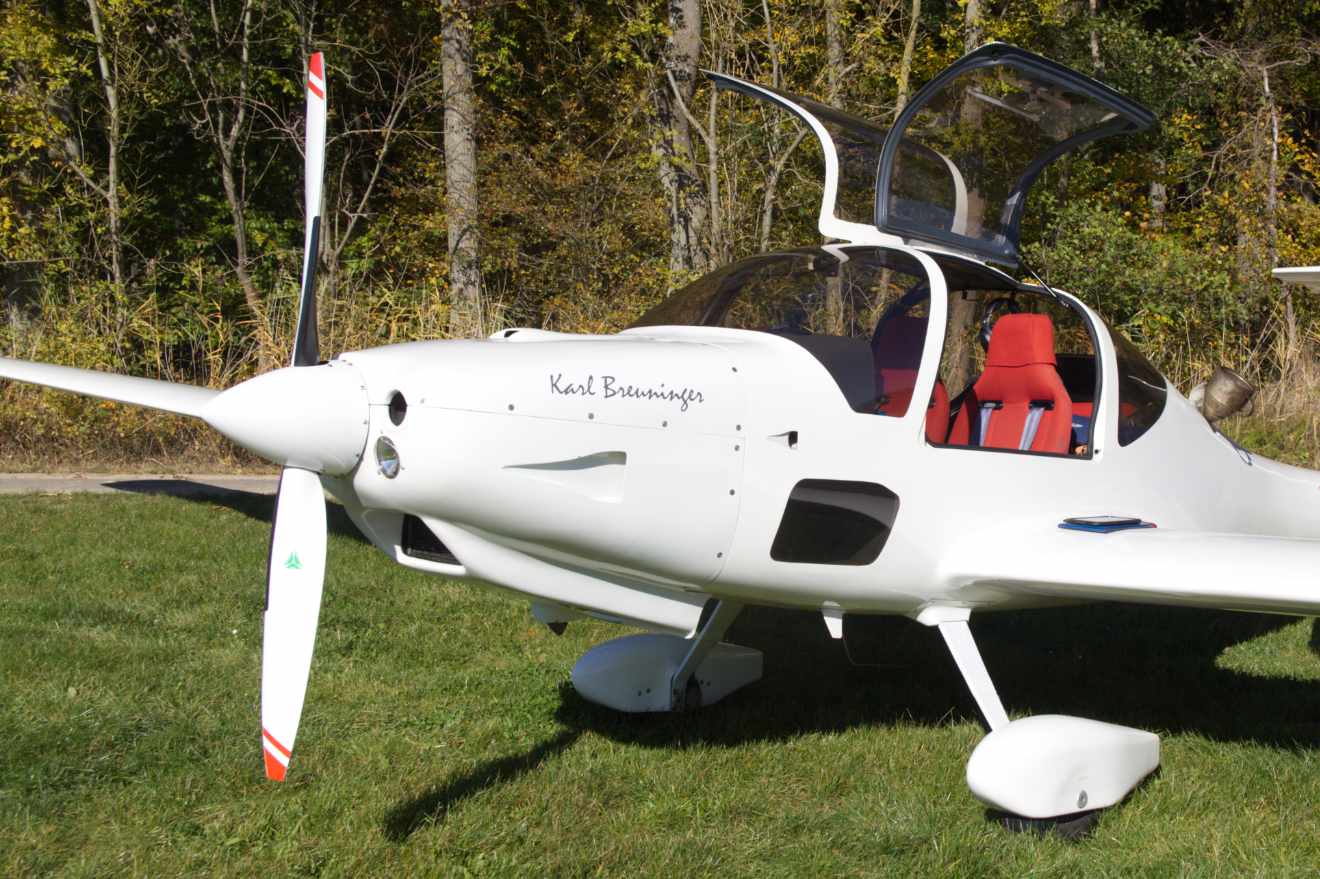
On 24.10.2021 we carried out a flight test in Hermuthausen to investigate the performance of standard mobile cellular phone network technology in the lower airspace. The test was conducted with a Grob G 109 turbo touring motor glider.
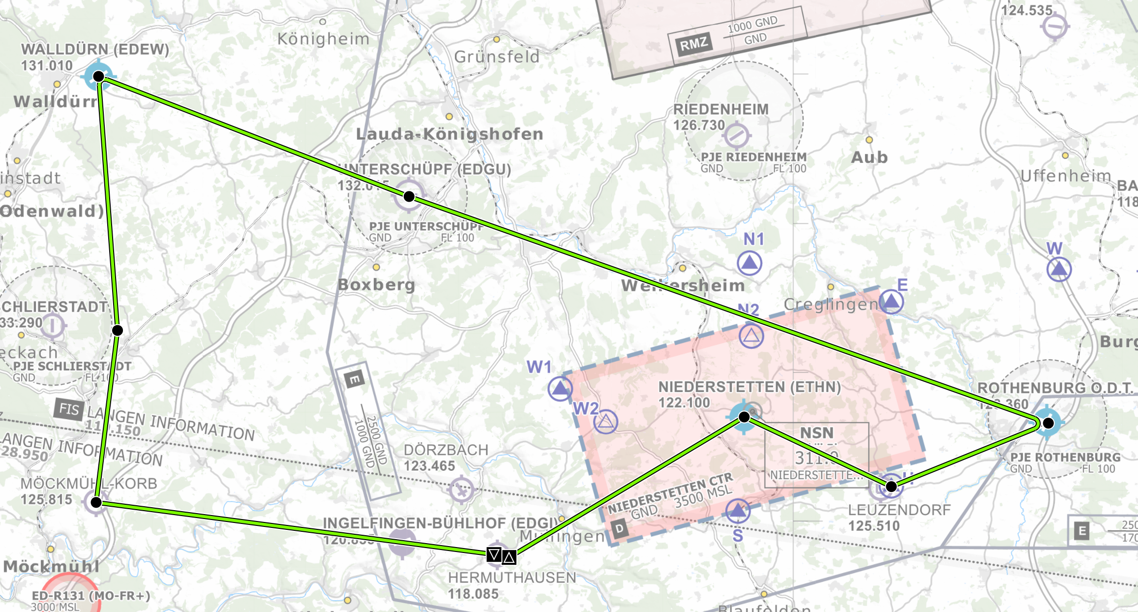
The test route was planned as a round trip from Hermuthausen via Niederstetten, Leuzendorf, Rothenburg, Unterschüpf, Walldürn, Möckmühl back to Hermuthausen with a landing exercise at each of these locations.
2. The test flight
2.1. Equipment
-
Netgear AirCard 810S
-
Netgear AirCard external MIMO Antenna
-
Samsung Android Tablet Galaxy Tab S4
-
Network provider Congstar
2.2. Software
The software on the tablet is written for Android with Kotlin/Java and Jetpack Compose. It communicates with a ground station via standard mobile cellular phone network technology provided by a mobile router from Netgear which provides a WLAN for the tablet. The data exchange is handled by the MQTT Eclipse Paho client library. On the server side an Eclipse Mosquitto MQTT server was used and the ground control software acts as just another MQTT client for this server. The server is hosted by Hetzner in Nürnberg.
2.3. Actually flown track
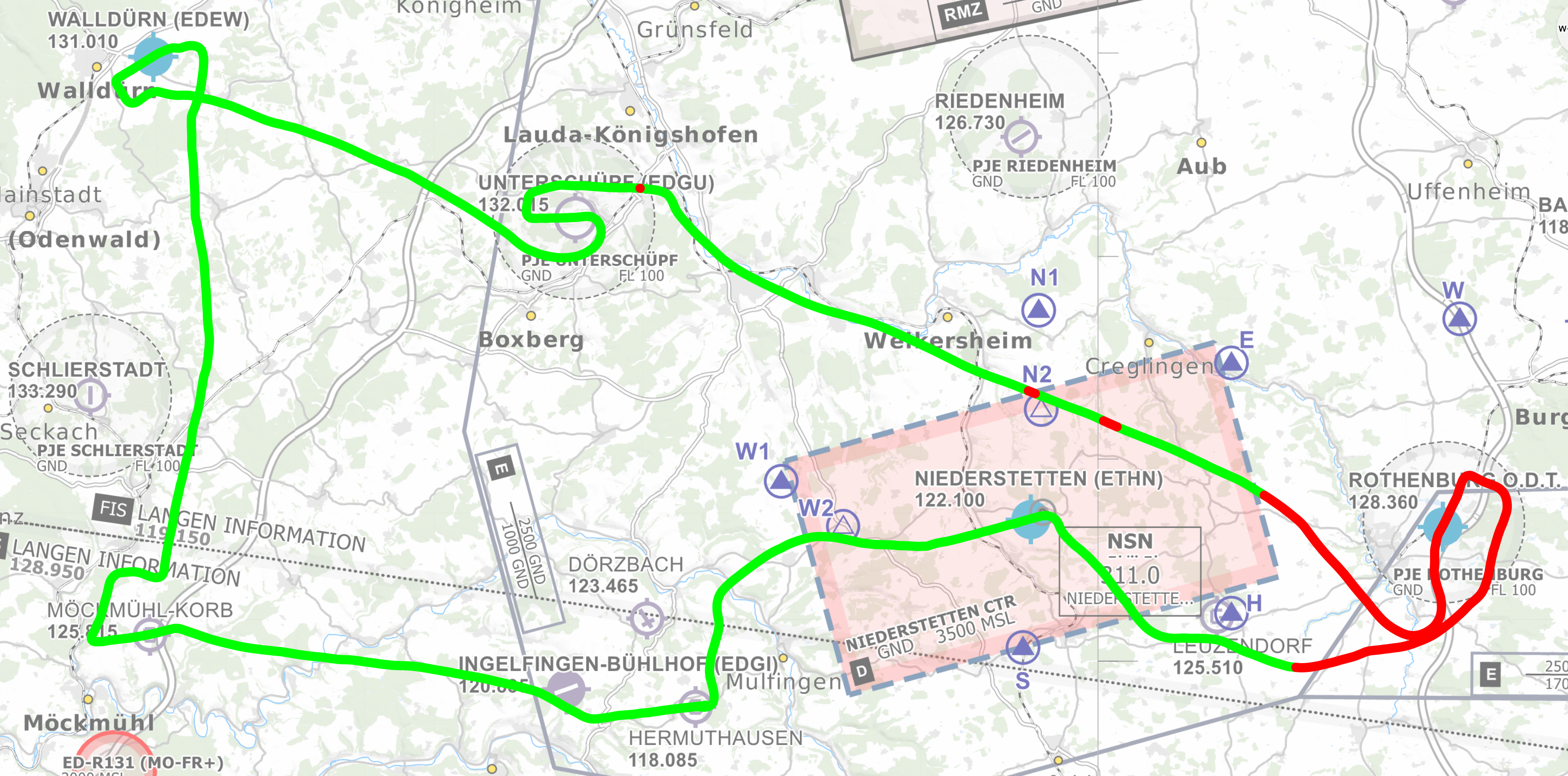
The actually flown track deviates slightly from the planned route because of either other air traffic or because of the necessary adjustments to the currently used runways for the landing exercises.
The green color indicates that we were connected to the ground station and the red color indicates that the connection was lost. One can see that for the most part of the route we were connected, but we had one major loss of connection near Rothenburg and three additional minor interruptions.
2.4. Altitude profile
The altitude profile shows a constant succession of climb and descend segments due to the landing exercises. It also shows that the major loss of connection is not due to excessive altitude. At Rothenburg we did not even have any reception near the ground. The reason for this needs further investigation but the most likely reason are antenna down tilts in that region. Rothenburg is a tourist attraction and especially in summer it is crowded with visitors. So the mobile phone density in this area is very high and one technique to cope with that is to tilt the antennas downward so that you can have more cells in one area without disturbing each other too much. This has a negative effect of course on the reception up in the air.
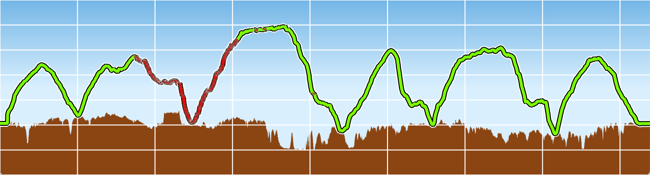
The grid cell altitude spacing in the graphics above is 200 m and the time spacing is 10 minutes. The whole flight time was a little over 80 minutes.
3. Conclusion
For 84% of the time we had a stable network connection and all data was transmitted without any significant latency. (In the order of 200 ms) but for 16% of the time we had a complete and long-lasting network loss where no data could be transmitted.
In the next flights we will collect more data simultaneously over different networks. This will make it possible to find out whether network losses, like the observed one, are specific to a particular network or not. We will also investigate the use of alternative network technologies like LTE-M Cat1.
4. Links
Netgear mobile router: https://www.netgear.com/de/home/mobile-wifi/hotspots/ac810/
Netgear external MIMO antenna: https://www.netgear.de/support/product/MIMO%20Antenna%20(6000450).aspx
Samsung Galaxy Tab S4: https://www.samsung.com/de/tablets/galaxy-tab-s/
(The S4 is not built anymore.)
Network: https://www.congstar.de/prepaid/prepaid-daten-tarif/
(Uses the german Telekom network.)
Hetzner: https://www.hetzner.com/de/cloud
Eclipse Paho: https://www.eclipse.org/paho/
Eclipse Mosquitto: https://mosquitto.org/
Antenna down tilt: https://en.wikipedia.org/wiki/Beam_tilt
5. Contact
mpMediaSoft GmbH
Schönaicher Str. 3
70597 Stuttgart
Tel. +49 711 765-4094
E-Mail: info@mpMediaSoft.de